
Archives
-

Vol. 4 No. 1 (2025)
Cover Caption: The Tunari Peak (Cochabamba Department, Bolivia), reaching nearly 5000 m above sea level and representing the last such elevation within the Eastern Cordillera of the Central Andes, is located at the core of the Bolivian Orocline. The massif is composed predominantly of metamorphosed Ordovician sedimentary rocks, overlain by continental deposits ranging in age from the Cretaceous to the Neogene. Access to the summit is relatively straightforward: from the city of Cochabamba, it requires approximately two hours by vehicle, followed by a four-hour hike across slopes dipping 7–15°. Along the ascent, small petrified fossils can be observed within the outcrops, while native fauna such as viscachas (Andean rodents) and allkamaris (Andean eagles) accompany the climb. The route also offers exceptional vantage points for landscape photography.
The scientific significance of this site is linked to the Proyecto del Oroclino Boliviano (POB), which aims to identify active faults potentially responsible for microseismic activity in the Cochabamba Basin. During field investigations, we were surprised to identify left-lateral strike-slip fault scarps at high elevation within a dominantly compressional setting such as the Eastern Cordillera. This unexpected structural evidence provided strong motivation to install seismic stations and develop a dedicated workflow to detect microseismic events and determine low-magnitude (M < 3) focal mechanisms. These efforts contribute to a better understanding of the complex seismotectonic behavior of the Bolivian Orocline’s core. Credit: Gonzalo Antonio Fernández Marañón -

Vol. 3 No. 2 (2024)
Cover caption: Kane Springs Tower, a 36-m-high Wingate sandstone tower in southeastern Utah and the subject of more than two years continuous seismic monitoring by a team from the University of Utah. Typically getting to the top of tall towers requires technical climbing, but this site is uniquely accessible being separated from the adjoining cliff by about a meter-wide gap, crossing which provides access to the mostly level working area on top. Nevertheless, getting to the top of the cliff was a difficult hike with no trail up the steep boulder-strewn slope, one that the research team often found many various words to describe, and some field assistants swore they would never do again. The rock tower vibrates at a clearly resolved fundamental resonance mode (around 1 Hz) whose frequency drifts over the year and on the daily scale. Interestingly, while the few other similar datasets reported show that frequencies vary directly with temperature sometimes with or without a phase lag, data from Kane Springs Tower shows that frequency changes actually precede seasonal temperature changes. This curious observation led the research team to discover that the annual pattern of insolation is actually controlling annual frequency drifts, and that aspects of daily drifts are similarly controlled by insolation patterns. Credit: Jeff Moore
-
Vol. 3 No. 1 (2024)
Cover caption: Drone-based lidar platform preparing to land after conducting a survey near Shä́r Ndü Chù (Duke River), Yukon, Canada, as part of a broader project coordinated by the Yukon Geological Survey to study the neotectonics and geothermal potential of the Eastern Denali fault. The drone offers a cost-effective way of obtaining otherwise expensive airborne lidar data, and compares favorably against established methods of topographic mapping, allowing landscapes to be surveyed in finer detail than was previously possible. This technology is particularly important in forested regions where dense vegetation would otherwise obscure subtle landforms, such as those produced by crustal faults in low strain settings. Credit: Guy Salomon.
-
Special Issue: the Cascadia Subduction Zone
Vol. 2 No. 4The Cascadia Subduction Zone: Grand Challenges and Research Frontiers
Subduction zones generate the world’s largest earthquakes. Their strong shaking and related cascading hazards such as tsunamis, landslides, liquefaction, fire, etc., make them the source of some of the most devastating natural hazards. The Cascadia Subduction Zone (CSZ), spanning three states in the U.S. and British Columbia in Canada, is such a hazardous system and at the same time represents one of the world’s best natural earthquake laboratories. While the Cascadia megathrust is seismically quiet compared to many other subduction zones, fundamental discoveries on phenomena including slow slip and tremor have shown it to be a hub of tectonic activity. Moreover, the region hosts one of the most comprehensive geologic records of past great earthquakes. Research involving the CSZ has yielded some of the most intriguing recent advances in the physics and impacts of earthquakes, and, fresh ideas and future scientific endeavors are required to foster and accelerate this progress.
Production Editors: Alice-Agnes Gabriel and Christie Rowe
Guest Editors:
Brendan Crowell (geodesy)
Colin Amos (tectonic and EQ geology)
Isabel Hong (paleoseismology)
Jason Padgett (paleoseismology)
Pieter-Ewald Share (high-res geophysical structural imaging)
Emilie Hooft (shoreline crossing seismics)
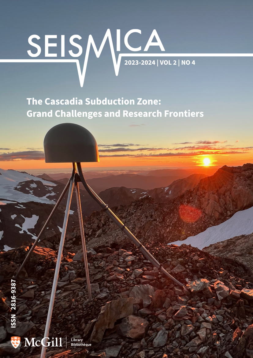
Harold Tobin (marine geology, fluids, faults)Cover caption: One of the Pacific Northwest Geodetic Array (PANGA) sites atop Mt. Olympus, Washington. Photo credit: Harold Tobin (University of Washington/Pacific Northwest Seismic Network).
-
Vol. 2 No. 2 (2023)
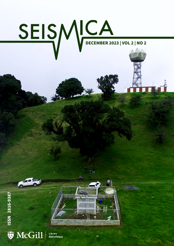
Cover caption: In 2021, the National Institute of Seismology, Volcanology, Meteorology, and Hydrology (INSIVUMEH) of Guatemala carried out a significant expansion of the National Seismological Network (RSN) by installing 15 permanent seismic stations with real-time transmission. Each station was equipped with a broadband sensor and an accelerometer. These seismic stations notably enhanced seismic monitoring in Guatemala and were also shared with international seismological agencies, thereby serving a crucial role in earthquake and tsunami early warnings in the region. The image shows the installation work of the “Las Nubes (the clouds)” seismic station (GUSP code) located in San José Pinula, Guatemala Department (23 km from the Capital City). In the background (top of the photo), there is also a meteorological radar belonging to INSIVUMEH. Credit: INSIVUMEH staff.
-
Special Issue: 2023 Türkiye/Syria earthquakes
Vol. 2 No. 3Insights and lessons from the devastating 2023 Kahramanmaraş, Türkiye earthquake sequence
We are all absolutely heartbroken at the sheer devastation and loss of life following the Mw7.8 and Mw7.5 earthquakes that hit Türkiye and Syria in January 2023. As seismologists and earthquake scientists, we know all too well about the power of earthquakes, yet the horrendous scenes coming out of Türkiye and Syria have still hit us hard. There will be numerous scientific analyses from the dense geophysical and geological datasets that captured these earthquakes and their consequences. We hope that these lessons will directly feed into improved disaster risk reduction worldwide. To improve dissemination of these vital scientific insights, Seismica is announcing a special journal issue on this important earthquake sequence, with papers free-to-publish and free-to-read.
For more information on submitting a paper, please see the issue announcement.
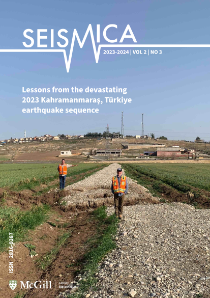
Cover caption: Displacement along the Narli fault, which initiated the 2023 Kahramanmaraş, Türkiye earthquake sequence. Farm road east of the town of Narli displaced 3 m left-laterally and 80 cm vertically up-to-the-east across a 6-m-wide graben. Geologists Rich Koehler (University of Nevada Reno) and Kevin Clahan (Lettis Consultants International, Inc.) mark the linear northern margin of the road. Photo credit: Cengiz Yildirim (Istanbul Technical University)” -
Vol. 2 No. 1 (2023)
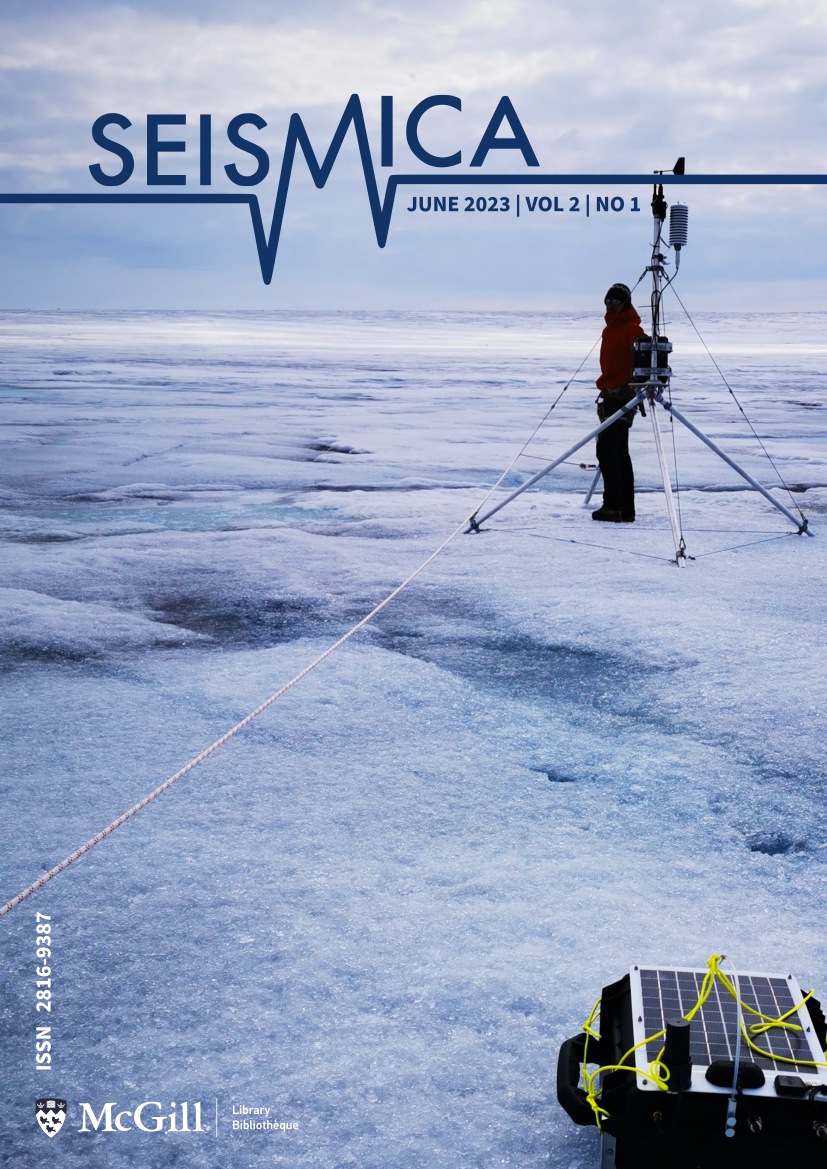
Cover caption: Installation of a weather station and self-sufficient seismic box on a Greenlandic outlet glacier. The glacier is called Sermeq Kujalleq in the Kangia icefjord (also known as Jakobshavn isbræ). The photo was taken at the fast ice stream approximately 60 km from the calving front. Installation of instruments at such locations can only be achieved by helicopter. The installation of the stations was part of the 2021 field campaign within the COEBELI project from the University of Zürich. The COEBELI project aims at investigating short-term ice flow dynamics with a combination of various field measurements. The total field campaign consisted of the installation of eight self-sufficient seismic box stations, two weather stations, two GPS stations, terrestrial radar measurements, and time-lapse cameras. More field campaigns with a larger number of sensors were done in 2022 and are planned for the summer of 2023. Credit: Ana Nap (photographer) and Adrien Wehrlé (in the picture)
-
Vol. 1 No. 1 (2022)
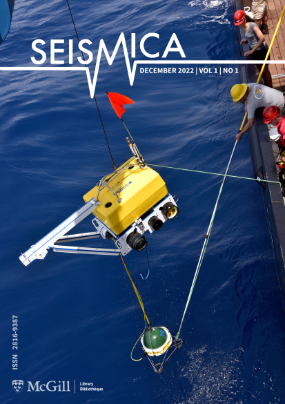
Cover caption: Ocean bottom seismometer (OBS) recovery. OBS recovery occurred in March 2017 as part of the PI-LAB (Passive Imaging of the lithosphere-asthenosphere boundary) experiment and EURO-LAB (Experiment to Unearth the Rheological lithosphere-asthenosphere boundary). The experiments included 39 ocean bottom seismometers deployed for 1 year around the Chain Fracture Zone and the equatorial Mid-Atlantic Ridge. The OBS were co-located with 39 ocean bottom magnetotelluric instruments deployed as part of the CA-LAB (Central Atlantic Imaging of the lithosphere-asthenosphere boundary) experiment. There were also several co-located active source experiments. The goal of the experiments was to determine what makes a plate, ‘plate-like’ by studying young ocean lithosphere with a range of sensitivities and resolutions at a slow spreading end member, the Mid-Atlantic Ridge. Credit: Catherine Rychert and Michael Kendall.


